- 3:02 h
- 10.28 km
- 118 m
- 557 m
- 564 m
- 1,082 m
- 518 m
- Start: Brünigpass, Station Brünig-Hasliberg
- Destination: Brienz
The descent from Brünig to Hofstetten is at some places steep and slippery. For safety reasons, solid shoes and walking sticks are advisable. Pilgrims walking alone should if possible join others on this stretch. For less experienced mountain walkers, a recommendable alternative route leads via Meiringen to Brienz.
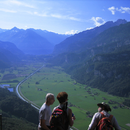
The railway station on the Brünig pass is starting point for the next stage. We follow the “Jakobsweg” signposts and walk at first on the main road to the big curve where we climb on a stairway up to a gravel path which leads us first over rocks and then atop the retaining wall of the main road. Then we follow a field path beside the road and after a short distance turn off to the right and across the sloping meadows of “Herwäg” and through a wood, we reach the extensive alpine pastures of “Bräch”.Now the path leads through the “Uoch” wood, and through rock ledges until we reach the turnoff to the lookout point “Tschuggen” (1096), the highest elevation of this stage. From the turnoff, we descend, and following the course of the brook that leads down to the village, we reach Brienzwiler lying 400 m lower (680m). Moss-grown blocks of stone and fern bushes border the stony path which at first descends quite steeply. The mountain path requires great precaution, despite the fact that lately, steps had been made with tree-trunks, barricades were erected and the railing was extended at dangerous places. Further down, we come to the old mule path with pack walls.
Good to know
Best to visit
Directions
Nearby
