- 2:45 h
- 6.97 km
- 230 m
- 230 m
- 1,286 m
- 1,499 m
- 213 m
- Start: Springenboden (Horboden)
- Destination: Springenboden (Horboden)
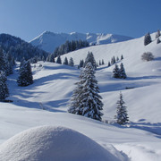
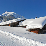
The 15-kilometre winter trails on Springenboden take you through the snow-decked forests and fields along the Diemtigtal’s southern slope, high above the floor of the Diemtigtal Nature Park. The trail via “Alp Ottenschwand” is rather challenging and reaches an elevation of up to 1500 metres above sea level. After the climb, you are rewarded by a stunning view into the back of the Diemtigtal and the Simmental. Back at the start of the trail, winter hikers can warm themselves over a hot drink in one of the mountain lodges.
The shorter options (“Ahorni-Satteli” and “Neuenstift-Satteli”) are perfect for short walks with a relatively steady gradient.
Good to know
Best to visit
Directions
Equipment
Directions & Parking facilities
Additional information
Verein Berner Wanderwege, Bern, Tel.: 031 340 01 01, E-Mail: info@beww.ch, Homepage: www.bernerwanderwege.ch
Author´s Tip / Recommendation of the author
Option A: Ahorni 3 km, 71 metres of elevation gain, highest point 1,400 metres above sea level, hike time 1.5 hrs
Option B: Neuenstift, 147 metres of elevation gain, 5 km, highest point 1,476 metres above sea level, hike time 2 hrs
Safety guidelines
Map
Nearby


